Welcome
.png)
Never stop learning
| 1 | The Basics of ODK Aggregators |
| 2 | Creating an ACCOUNT with Kobo |
| 3 | Uploading a FORM to Kobo |
| 4 | Hands-on Excersis |
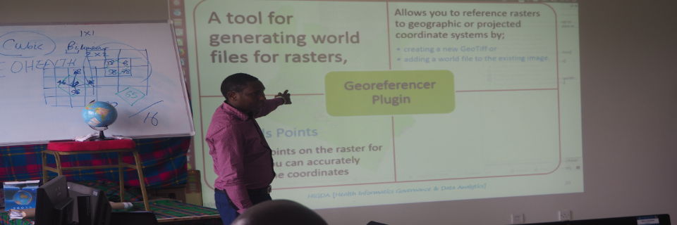
| 1 | Basics of Spatial Epidemiology & GIS |
| 2 | Overview of GIS Software & GPS Data Collector |
| 3 | Working with QGIS |
| 4 | Mapping & Spatial Analysis |
| 5 | Density Mapping, Patterns, Correlation & Trend Analysis |
Geovisualization shows the relationships between geography and voting patterns
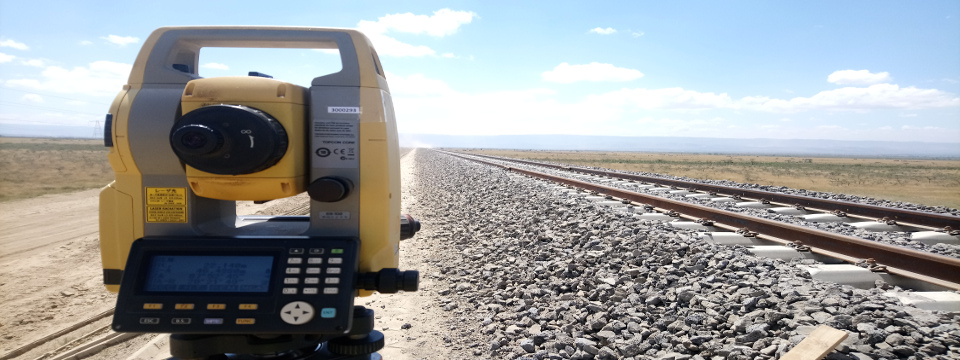
Topographic Surveys
To help professionals understand geography
For design, planning & engineering
Spatial Data Analysis
Using the science of where to give you insights
Use data to inform your decisions
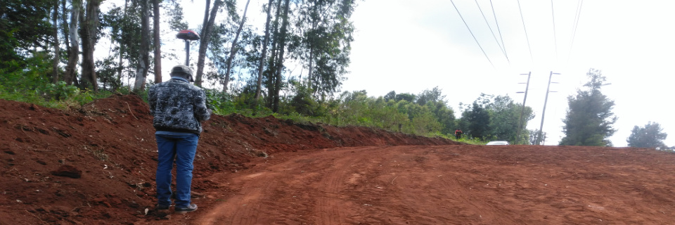
Sectional Surveys
Sectional surveying refers to 3D cadastral surveying
Deliverables; surveys plans & sectional title
| Topics | Lectures |
|---|---|
| Introduction | Lesson#1 |
| HTML & CSS | Lesson#2 |
| Web Mapping | Lesson#3 |
| Designing Web Maps | Lesson#4 |
| Introduction to JavaScript | Lesson#5 |
| JavaScript & JQuery | Lesson#6 |
| Mapping Frameworks | Lesson#7 |
| Server-side Technologies | Lesson#8 |
| PHP & AJAX | Lesson#9 |
| Web security & Projects | Lesson#10 |
| Node.js | Lesson#11 |
| Turf.js | Lesson#12 |
| D3.js | Lesson#13 |
| GeoNode | Lesson#14 |
| Project | Lesson#15 |
| Topics | Lectures |
|---|---|
| Basics of GIS | Lesson#1 |
| Basics of Remote Sensing | Lesson#2&3 |
| Cartography & Visualization | Lesson#4&5 |
| Global Positioning System | Lesson#6 |
| Topographic Surveying & Mapping | Lesson#7 |
| Data Analysis in GIS | Lesson#8 |