- Lectures
- Online tutorials
- Practical(s)
- Assignment(s)
- Presentation(s)
Mode of Course Delivery
Course Outline
- Introduction: Definition, world wide web (www) & web cartography
- Designing web services and web maps using Leaflet & Google Maps API
- Reading Data from various Data source
- Web mapping techniques; web design & development, hyperlinking, animations, web atlas, multimedia mapping
- Construction & publishing Geospatial information using HTML, GML
- Web mapping libraries and frameworks
- In this course; Leaflet & Google Maps API
Course Outcomes
- Understand the basics of client-server architecture
- Understand the basics of client side technologies [HTML, CSS, JavaScript]
- Understand the basics of server-side technologies [PHP, SQL, Databases]
- Client and Server Communication - AJAX
- Libraries and frameworks - JQuery
- Tools for geospatial applications - [Leaflet, Google Maps, Turf, PostGIS, GeoJSON]
Lecture 1: Introduction to Web Mapping
Web Programming
J Mwaura
Required knowledge
HTML & CSS syntax
- w3schools.com
- w3resources.com
Basic JavaScript programming skills
Map service; WMS, WMTS &am; TMS
QGIS or ArcGIS
Make Google your friend
Evolution of Web Technologies

HTML, CSS & JS
HTML - allows us to structure content for our web page. Our map will be contained in an element within an HTML file
CSS - gives us control of the style and visual presentation of our web page. We will use it in the placement and sizing of the map and to customize some Leaflet elements
JavaScript - gives us the ability to add interactivity to our web page. We will use it to pull in map tiles to our web page, add data (or content layers), and handle user interaction with the map
Services & JavaScript Libraries
Google Map - Google Inc
Leaflet - CloudMade
Openlayers - OpenStreetMap
Bing Maps, Here Maps, ArcGIS Online, MapBox.
Library Comparison
| Name | Open Source ? | Free ? | Limitations |
|---|---|---|---|
| Google Maps | No | Daily | Licence |
| Leaflet | Yes | Yes | skills & time |
| Here Maps | No | Monthly | Licence |
| ArcGIS Online | No | No | Licence |
| Openlayers | Yes | Yes | skills & time |
| Bing Maps | No | Monthly | Licence |
| MapBox | (Yes) | Monthly | Licence |
Commercial Services
Registration needed You get an API key
- Identifies your application
- Used to monitor the usage of your service
- Reference the key in your JavaScript files
1. Google Maps
Base maps (4 options available)
Add your own data
2. ArcGIS Online
Choose base maps
Add your own data & styles
Publish/share your map as an application
- Application templates available
- Available at GitHub
Edit the application with JavaScript API
3. MapBox
Design maps with the MapBox Studio
Reference your design by id in your JavaScript file
Vector tiles
Based on OpenSource APIs
4. Openlayers
Completely rewritten OL3
More features by default
5. Leaflet
Simple & lightweight (it is only 28kb of code)
Mobile friendly
Simple API
Not many features included
Easier to learn if you don't know JavaScript well
Which library to choose?
Considerations
Base maps
Free WMS/TMS/WMTS servers
User interface & layout
Bootstrap framework (HTML, CSS, JS)
- Responsive
- A lot of ready building blocks
- Click bootstrap
Leaflet Plugin
Interactive map features
You should have some kind of interactivity in your map
- Filtering, style changes, search...
- Click jQuery
Easy-to-use API for event handling etc
Filtering with a slider: jQuery + noUiSlider
Handling coordinates
It's best to transform your data points to the same CRS as your base map in QGIS/ArcGIS
If you need CRS transformations in your JavaScript code, use proj4js
Debugging
Use browser tools
JavaScript code console.log(variable)
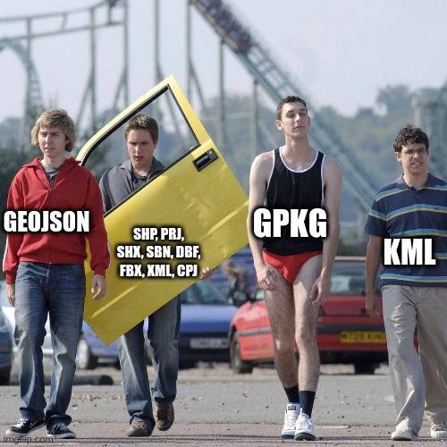
Spatial Data Formats
- File-based data
- Shapefile, KML, GeoJSON, & TopoJSON, gpx, csv
- Spatially-enabled database data
- Proprietary: Microsoft SQL Server, Oracle Spatial, & the Esri ArcSDE middleware
- Open equivalents: PostgreSQL with PostGIS extension, SQLite with SpatiaLite extension
- Raster formats
- Open raster formats JPEG, PNG, TIFF, BMP, GIF
Spatial File Structures: Shapefile
Included files
Spatial File Structures: KML
XML, wherein data is maintained in a series of structured tags
Spatial File Structures: GeoJSON
Data is arranged in a hierarchical series of key-value pairs with Discrete geometries
Spatial File Structures: TopoJSON
Encodes topology with Geometries that share sequences of positions called arcs
In Summary
End of Lecture 1
Web Programming
That's it!
Queries about this Lesson, please send them to:
*References*
- Google Maps; Power Tools for Maximizing the API, 2014
Evangelos Petroutsos- D3 Tips and Tricks; Interactive Data Visualization in a Web Browser, 2013
Malcolm Maclean- Interactive Data Visualization for the Web, 2013
Scott Murray- Web Programming with HTML5, CSS, and JavaScript, 2019
John Dean- Leaflet Documentation
Leaflet Team- Google Documentation for developers
Google Team
Courtesy of …