Lecture 5: Applications in GIS Monitoring

J Mwaura

Monitoring

Monitoring

Monitoring- systematic and continuous collection and analysis of information about the progress of a development intervention

Monitoring is done to ensure the people who need to know about an intervention are properly informed, & for timely decisions
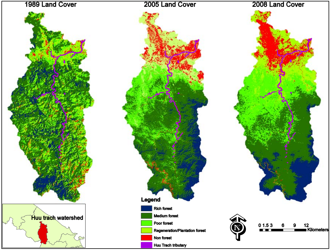
lulc
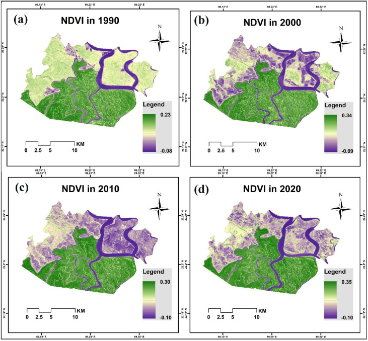
ndvi

Case Study: Deforestation in the Philippines

Objective- identify a range of different development scenarios that make it possible to anticipate future land use and habitat change, and hence also anticipate changes in biodiversity

Method

  1. used qualitative data collected through stakeholder interviews in a quantitative GIS-based analysis to calculate the probabilities of land use transition under three different scenarios of land use change
  2. The three different scenarios not only resulted in different forest areas by 2019 but also different spatial patterning of the remaining forest

Case Study: Deforestation in the Philippines

Scientific foundation

  • The theme of inferring process from pattern, or function from form, is a common characteristic of GIScience applications
  • Contrasts general and specific approaches

Principles

  • GIS makes it possible to incorporate diverse physical, biological, and human elements, and to forecast the size, shape, scale, and dimension of land use parcels
  • It makes use of the core GIS idea that the world can be understood as a series of layers of different types of information, that can be added together meaningfully through overlay analysis to arrive at conclusions

Case Study: Deforestation in the Philippines

Analysis- Process is inferred not just through size measures, but also through spatial measures of connectivity and fragmentation

Generic question

  • Irrespective of the quality of the measurement process, uncertainty will always creep into any prediction
  • Data are never perfect
  • Simulations are subject to exogenous forces not included
  • Users of GIS should always know exactly what the system is doing to their data

Assignment: Monitoring

Look for an article about monitoring the progress/status of conservation efforts. Submit a summary based on following issues

  • Objective
  • Method
  • Scientific foundation
  • Principle
  • Technique
  • Analysis
  • Generic question
  • Management & policy

End of Lecture

Applications of GIS

That's it!

Queries about this Session, please send them to: jmwaura@jkuat.ac.ke

*References*

  • Geographic Information System Basics, 2012 J.E.Campbell & M. Shin
  • Fundamentals of GIS, 2017 Girmay Kindaya
  • GIS Applications for Water, Wastewater, and Stormwater Systems, 2005 U.M. Shamsi
  • Analytical and Computer Cartography, 2nd ed. Keith C. Claike
  • Geographic Information Systems: The Microcomputer and Modern Cartography, 1st ed. Fraser Taylor
Courtesy of Open School